A Look at Galatia
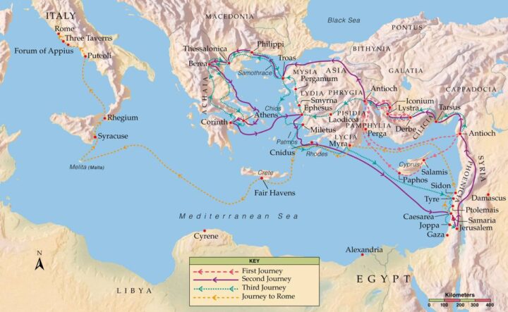
 This map shows the general area of Galatia, the setting of this quarter’s lessons, in what is now the country of Turkey. It is a region that forms a high plateau over 3000 ft (1000 m) in elevation and would have been more comfortable for Paul than Tarsus would have been since it is about 10 degrees cooler and a little dryer.
The purple line is the approximate route that Paul took on his second missionary journey.
The first missionary journey was through Perga and covered the three interior cites of Antioch, Iconium, and Lystra. The second and third missionary journeys were through the Cilician Gates, a mountain pass that goes through the Taurus Mountains that run from southwest to northeast of Tarsus, Paul’s home town (lower right on the map). Both missionary journeys were the same until they got to Pisidian Antioch (just below and a little left of the map’s center) which is part of Galatia. Another Antioch in Syria (extreme lower right on the map) served as Paul’s base of operation.
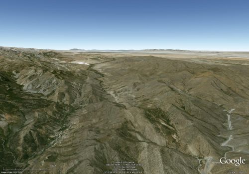
The view at right is about what you would see from an airplane flying over a point just north of the Cilician Gates looking toward Derbe and Iconium in the distance.

